




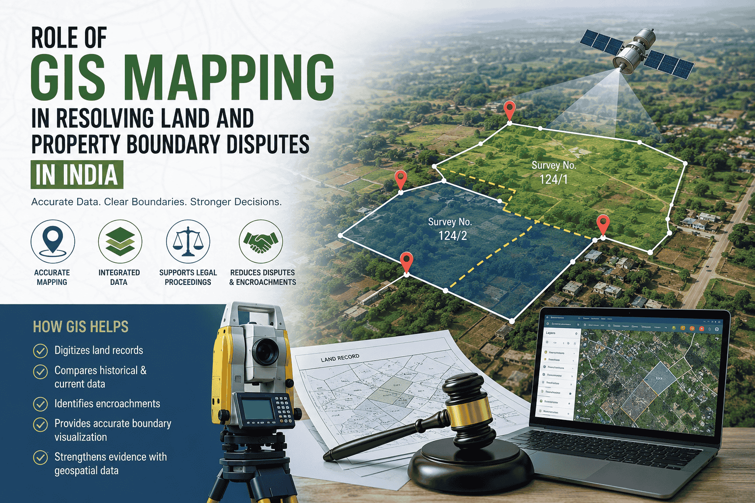
Land and Property Boundary Disputes
Land and property boundary disputes are among the most common sources of conflict in India. Disagreements may arise because of inaccurate land records, unclear boundaries, outdated survey maps, encroachments, overlapping claims, or differences between physical land conditions and official records. Resolving such disputes often requires reliable survey information and accurate documentation.
With the advancement of geospatial technology, Geographic Information System (GIS) mapping has emerged as an important tool for organising, visualising, and analysing land-related information. When combined with cadastral maps, satellite imagery, GPS or DGPS surveys, and official land records, GIS can help create a clearer representation of property boundaries and support the investigation of land disputes.
Understanding GIS Mapping in Land Administration
GIS is a technology used to collect, manage, analyse, and visualise information associated with geographic locations. In land administration, GIS can integrate information such as property boundaries, survey numbers, roads, buildings, water bodies, administrative boundaries, and land-use classifications into a single digital environment.
Traditional land records are often maintained through paper documents and survey maps that may have been prepared many years ago. While these records remain important, comparing them with current ground conditions can sometimes be difficult.
GIS provides a digital framework in which different sources of spatial information can be brought together. This makes it easier to identify inconsistencies, examine boundary locations, and understand the relationship between individual land parcels and surrounding properties.
Common Causes of Land Boundary Disputes
Property boundary disputes can occur for several reasons, including:
- Differences between old survey records and present ground conditions
- Unclear or damaged boundary markers
- Unauthorised encroachment onto neighbouring land
- Errors in measurement or documentation
- Subdivision of properties without properly updated spatial records
- Differences between cadastral maps and physical features
- Overlapping claims relating to adjoining properties
- Changes in roads, waterways, or other physical features
- Incomplete or outdated land records
In such situations, accurate spatial information can help investigators and authorities better understand the location and extent of the disputed property.
How GIS Can Help Resolve Property Boundary Disputes
1. Digitising Existing Land Records
One of the important applications of GIS is the conversion of traditional cadastral and survey information into digital spatial datasets.
Existing survey maps, parcel information, and other relevant records can be digitised and organised within a GIS environment. This allows land parcels to be displayed as digital polygons and linked with relevant attribute information.
Digitisation does not by itself determine legal ownership. However, it can make land-related information easier to access, compare, update, and analyse.
2. Comparing Cadastral Maps With Current Conditions
A major advantage of GIS is the ability to compare different layers of spatial information.
For example, an existing cadastral map can be compared with current satellite imagery or newly collected survey data. This may help identify apparent differences between recorded parcel boundaries and present physical conditions.
Such comparisons can be useful for identifying areas that require further field verification or official survey.
3. Identifying Possible Encroachments
GIS and remote sensing technologies can assist in monitoring land-use changes and identifying possible encroachments.
By comparing historical and recent satellite imagery, changes in structures, roads, land use, or other physical features may be detected. These observations can help identify areas requiring detailed investigation.
However, satellite imagery or GIS analysis should not automatically be treated as conclusive proof of ownership or encroachment. Legal authorities may require official surveys, title documents, registered records, and other admissible evidence.
4. Integrating GPS and DGPS Survey Data
Modern land surveys can use GPS and Differential GPS (DGPS) technology to collect geographic coordinates with a high degree of positional accuracy.
Survey points collected in the field can be incorporated into GIS databases and compared with existing cadastral information. This can help survey professionals identify differences between recorded and measured positions.
Where a dispute requires an authoritative determination of a boundary, the relevant government authority or qualified survey professional must carry out the appropriate survey according to applicable rules and procedures.
5. Creating Visual Evidence for Land Analysis
Land-related information can be difficult to understand when presented only through written descriptions and paper documents.
GIS can convert complex spatial information into maps that show parcel boundaries, adjoining properties, roads, structures, and other geographic features.
These visual representations can help lawyers, surveyors, property owners, government officials, and other stakeholders understand the geographical context of a dispute more clearly.
GIS and Legal Evidence
An important consideration is the distinction between technical information and legal proof.
GIS maps, satellite imagery, survey coordinates, and spatial analyses can provide valuable technical information. However, their legal significance depends on factors such as the source of the data, method of collection, accuracy, authentication, official records, and the applicable legal and procedural requirements.
For this reason, GIS should generally be viewed as a supporting technology rather than a replacement for title documents, registered records, official surveys, or judicial determination.
A GIS-based analysis can help identify questions that require further examination, while legally recognised documents and competent authorities remain central to determining ownership and boundary rights.
Role of GIS in Land Acquisition
GIS also has applications beyond private property disputes. It can support land acquisition activities by helping authorities and organisations identify affected parcels, analyse land use, map infrastructure, and understand the geographic extent of proposed projects.
When spatial information is accurately linked with parcel records, it can provide a clearer picture of which properties may be affected by roads, railways, industrial projects, utilities, or other infrastructure development.
This can contribute to better planning and more transparent land-related decision-making, subject to applicable land acquisition laws and procedures.
Challenges in Using GIS for Property Disputes
Despite its advantages, GIS cannot independently solve every land dispute.
Some of the major challenges include:
- Outdated cadastral records
- Inconsistent coordinate systems
- Differences between historical and modern survey methods
- Incomplete digitisation of land records
- Errors in source data
- Lack of standardised datasets
- Difficulties in linking spatial information with ownership records
- Need for field verification
- Legal requirements concerning the authenticity and admissibility of evidence
The quality of the final GIS analysis depends heavily on the quality and reliability of the underlying data.
The Future of Digital Land Management in India
India is increasingly moving toward digital land records, geospatial databases, online property services, and technology-assisted surveying. The integration of cadastral records with modern geospatial technologies can potentially make land administration more efficient and transparent.
Technologies such as GIS, satellite imagery, GNSS/DGPS surveying, remote sensing, and 3D geospatial data can provide additional tools for monitoring and managing land.
The long-term objective should not simply be to create digital maps but to develop reliable and regularly updated land information systems that connect spatial data with authoritative land records.
Conclusion
Land and property boundary disputes often involve complex combinations of historical records, physical measurements, ownership documents, and changing ground conditions. GIS mapping can help bring these different forms of spatial information together and provide a clearer picture of the geographical aspects of a dispute.
From digitising cadastral maps and comparing historical records to analysing satellite imagery and integrating modern survey data, GIS has significant potential to support land administration and property-related dispute analysis.
At the same time, GIS should be used carefully. A digital map is not automatically proof of ownership, and technological analysis cannot replace official records, authorised surveys, or judicial processes.
As India’s land administration systems continue to become more digital, the responsible integration of GIS mapping, surveying, remote sensing, and legal land records could play an increasingly important role in improving the accuracy, transparency, and efficiency of property management and boundary dispute resolution.
References:
- https://dsmsoft.com/Geospatial.aspx?id=MappingServiceOpen