




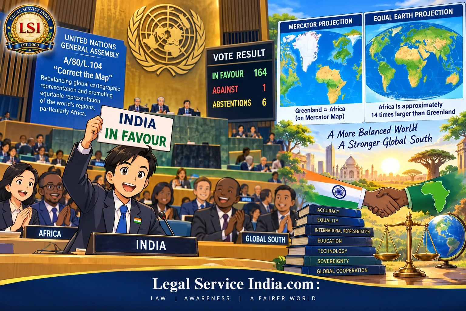
The United Nations General Assembly has taken a decision that, at first sight, may appear to concern nothing more than cartography. But beneath the question of how the world is drawn on a map lies a much deeper debate about accuracy, equality, international representation, education, technology, sovereignty, and the power of visual narratives.
On September 4, 2026, the United Nations General Assembly adopted the resolution “Correct the Map: Rebalancing global cartographic representation and promoting equitable representation of the world’s regions, particularly Africa,” identified as A/80/L.104. The resolution received 164 votes in favor, one against, and six abstentions.
Also Read: Can America Reform the Supreme Court? Latest 5–4 Ruling Reignites Term Limits Debate
India voted in favor.
India’s vote, however, must be understood carefully.
India did not endorse the proposition that one particular map projection—including the Equal Earth projection—should become the universally mandatory representation of the planet.
India’s explanation of vote took a more technically and legally defensible position: equal-area projections are particularly relevant where the objective is to preserve the relative sizes of continental and territorial land masses, but different projections serve different cartographic purposes, and no single projection is appropriate for every application.
That distinction is extremely important.
For India, therefore, this is not simply a story about changing a map.
It is a story about how international institutions can influence global norms without creating binding international law, how technical standards can acquire geopolitical significance, and how India is positioning itself within the emerging Global South diplomatic order.
What Did the United Nations Actually Decide?
The first legal question must be answered clearly.
Did the United Nations order the world to stop using the Mercator projection?
No.
The General Assembly adopted a resolution encouraging more accurate and equitable cartographic representation. The measure does not constitute a treaty, does not redraw international boundaries, and does not automatically impose a binding legal obligation upon India, other states, schools, publishers, or technology companies. Contemporary reporting likewise describes the resolution as voluntary/non-binding.
The UN’s official schedule records the measure as
A/80/L.104 — “Correct the Map”: Rebalancing global cartographic representation and promoting equitable representation of the world’s regions, particularly Africa.
This distinction between a politically significant resolution and a legally binding international instrument is fundamental.
A General Assembly resolution should not automatically be treated as equivalent to a treaty or convention.
Yet it would equally be wrong to dismiss it as legally meaningless.
UN General Assembly resolutions can contribute to the development of international norms, influence state practice, guide international organizations, and shape political expectations.
Thus, although the resolution does not itself change international law, it may influence the normative environment in which international law and international policy develop.
Why Was the “Correct the Map” Resolution Necessary?
The problem begins with a mathematical reality.
The Earth is approximately spherical.
A conventional flat map is not.
When a three-dimensional globe is transformed into a two-dimensional surface, some form of distortion is unavoidable.
The cartographer must decide what to preserve:
- area;
- shape;
- direction;
- distance;
- angles; or
- a compromise between several characteristics.
The famous Mercator projection, developed by Gerardus Mercator in 1569, became enormously important because it preserves direction in a way particularly useful for navigation.
Its weakness is different.
It substantially enlarges areas towards the poles.
Consequently, regions in northern and southern high latitudes can appear much larger than their actual surface areas, while areas closer to the equator appear comparatively smaller.
One of the most striking examples is Greenland and Africa.
On many Mercator maps, Greenland appears visually comparable to Africa.
In reality, Africa is approximately fourteen times larger than Greenland.
The important point, however, is that this does not make the Mercator projection “wrong.”
It makes it unsuitable for certain purposes.
That distinction is central to India’s position.
Also Read: World Inequality Report 2026: India’s Wealth Gap, Top 1%, and Economic Inequality
A Map Can Be Technically Correct for One Purpose and Misleading for Another
This is where much of the public debate has become unnecessarily polarized.
It is tempting to describe one map as “correct” and another as “incorrect.”
That is scientifically simplistic.
A projection designed to preserve navigational direction performs a different function from one designed to preserve relative land area.
Therefore:
The question is not merely which map is correct. The question is what the map is being used to demonstrate.
If the purpose is navigation, preservation of direction may be crucial.
If the purpose is comparing the sizes of continents, preservation of area becomes much more important.
If the purpose is displaying a weather system, analyzing satellite data, producing a GIS dataset, or designing an aviation chart, yet another projection may be appropriate.
India’s explanation of the vote reflects precisely this principle of purpose-specific cartographic accuracy.
What Is the Equal Earth Projection?
The Equal Earth projection is an equal-area projection developed to represent continents and countries according to their relative surface areas while maintaining recognizable forms.
It therefore produces a very different visual impression of the world from the Mercator projection.
Africa appears substantially larger.
High-latitude regions appear less exaggerated.
The African-led campaign has promoted Equal Earth as an important example of an alternative that better communicates relative continental size. Contemporary reporting identifies Equal Earth as a principal projection associated with the initiative.
But India’s position contains an important qualification.
India did not say:
Equal Earth must replace every other map.
Instead, India supported the principle of encouraging equal-area approaches where preserving relative landmass size is the objective.
This is a much more technically defensible position.
India’s Explanation of Vote: The Most Important Part of the Story
For a legal and policy audience, India’s explanation of the vote deserves considerably more attention than the simple headline that India voted “yes.”
India’s position can be reduced to four important propositions.
1. Relative Area Matters
Where the purpose of a map is to compare continental or territorial land masses, equal-area projections have considerable value.
2. No Projection Is Universally Perfect
Every cartographic projection involves compromises.
3. Different Purposes Require Different Maps
Navigation, education, geographic analysis, aviation, and other applications may require different projections.
4. Cartographic Methodology Should Remain Neutral
India therefore supported accurate representation while avoiding unnecessary endorsement of one specific technical methodology.
This is a particularly sophisticated position.
India is effectively saying:
Correct the distortion where area comparison matters, but do not replace one universal orthodoxy with another.
That is the real significance of India’s vote.
The International-Law Question: Is the Resolution Binding on India?
This is perhaps the most important legal question for readers of LegalServiceIndia.com.
The answer is no, not in the same manner as a binding treaty obligation.
The resolution does not itself create a new sovereign obligation requiring India to amend its domestic laws or immediately replace every map used in the country.
It does not:
- alter India’s Constitution;
- amend an Indian statute;
- redraw India’s international boundaries;
- alter territorial sovereignty;
- settle a boundary dispute;
- invalidate existing maps;
- prohibit the Mercator projection; or
- automatically impose obligations upon Indian private companies.
The immediate legal effect is therefore limited.
But legal significance and legal enforceability are not identical concepts.
A UN resolution can have normative and diplomatic significance even where it lacks direct binding force.
This distinction should always be maintained when reporting UN General Assembly developments.
Does the Resolution Change India’s International Borders?
Absolutely not.
This issue deserves special emphasis because maps and territorial disputes can sometimes become intertwined.
A cartographic projection is a mathematical method of displaying geographic information.
An international boundary is a question of sovereignty, territorial title, treaty interpretation, historical evidence, international law, and, where applicable, judicial or arbitral determination.
Changing the projection does not change the boundary.
For example, depicting India on an equal-area projection does not itself:
- confer new territory upon India;
- surrender existing territory;
- recognize another state’s territorial claim;
- settle a disputed border; or
- alter India’s sovereign rights.
Therefore, the “Correct the Map” resolution should not be interpreted as a territorial or boundary settlement.
That distinction is especially important for Indian legal reporting.
Why Is the Vote Significant for India?
India’s support has significance on at least seven levels.
1. India’s Global South Diplomacy
India has increasingly sought to position itself as a strong voice for developing countries and the Global South.
The present initiative was led by African countries, with Togo championing the resolution on behalf of the African Group. The African Union has described the initiative as a significant step towards more accurate and equitable cartographic representation.
India’s support therefore strengthens its diplomatic engagement with African states.
It demonstrates that India’s Global South diplomacy is not confined to trade, development assistance, or political declarations.
It can also extend to questions concerning international representation and institutional fairness.
2. Strengthening India-Africa Relations
Africa is increasingly important to India’s strategic interests.
The relationship extends across:
- Trade;
- Energy;
- Critical minerals;
- Pharmaceuticals;
- Agriculture;
- Maritime security;
- Infrastructure;
- Education;
- Digital technology;
- Defense;
- Space cooperation; and
- Multilateral diplomacy.
Supporting an African-led initiative at the United Nations can contribute to diplomatic goodwill.
India is therefore not merely supporting a cartographic proposition.
It is also reinforcing the message that African perspectives deserve serious consideration within multilateral institutions.
3. India Supports Accuracy Without Politicizing Science
There is another dimension that deserves attention.
India could have simply supported the adoption of Equal Earth.
It chose a more careful approach.
That matters because scientific standards can become politicized when a technical solution is presented as the only morally acceptable one.
India avoided that trap.
Its position recognizes that:
- Scientific accuracy depends upon the question being asked.
That principle extends well beyond cartography.
4. Educational Implications for India
The resolution presents India with an opportunity to rethink geographical education.
Indian students are accustomed to seeing conventional rectangular world maps.
But how many are taught that every flat map necessarily distorts something?
This should change.
Indian textbooks could explain:
- Why the Earth cannot be perfectly represented on a flat surface;
- Why different projections exist;
- Why Africa appears different on different maps;
- Why Greenland appears disproportionately large on Mercator maps;
- Why equal-area projections are useful for comparisons; and
- Why navigation may require different projections.
This would not merely change the map.
It would improve scientific literacy.
5. Implications for India’s Geospatial and Mapping Industry
The issue also has a technology dimension.
Modern mapping is no longer confined to paper.
Geospatial information now drives:
- Urban planning;
- Disaster management;
- Agriculture;
- Defense;
- Logistics;
- Telecommunications;
- Infrastructure;
- Environmental monitoring;
- Satellite applications;
- Navigation; and
- Artificial intelligence.
India’s expanding geospatial ecosystem could benefit from a greater emphasis on projection-aware mapping.
Rather than asking which projection should replace another, Indian technology companies could develop systems that select or display projections according to the user’s objective.
That would be a more sophisticated technological response.
6. The AI Revolution Makes the Issue More Important
There is a further development that the current debate has not sufficiently explored.
Artificial intelligence increasingly generates visual information.
AI systems can create:
- Educational maps;
- Geographic diagrams;
- Statistical visualizations;
- News graphics;
- Travel maps;
- Location explanations; and
- Geographic summaries.
If an AI system repeatedly produces distorted visual representations of the world, those representations can reach millions—or potentially billions—of users.
The cartographic question is therefore becoming a data-governance question.
Who decides how the world is visually represented in AI-generated content?
Should an AI system distinguish between:
- A navigation map;
- A political map;
- An area-comparison map;
- A statistical map; and
- An educational map?
India’s technologically neutral position is well suited to this future.
7. It Has a Broader International Institutional Significance
The resolution demonstrates that seemingly technical standards can become matters of international diplomacy.
Cartography intersects with:
- History;
- Education;
- International relations;
- Colonial legacies;
- Development;
- Identity;
- Technology;
- Data governance; and
- Geopolitics.
That is why the vote attracted such overwhelming support.
The General Assembly adopted the measure by 164 votes to one, with six abstentions. The United States was the lone opposing vote.
The numerical margin is itself politically significant.
Why Africa Wanted the Map Changed
The campaign is fundamentally driven by concerns about how Africa is visually represented.
The African Union has argued that commonly used projections can make Africa appear substantially smaller than its actual size. The campaign connects that issue to education, global perception, and the historical legacy of cartographic conventions.
The argument is not that generations of students literally believed Africa was physically smaller than it is.
The argument is subtler.
Repeated visual representation can influence perception of geographical scale and relative importance.
This raises an important jurisprudential and philosophical question:
Can a technically neutral representation have socially significant consequences?
The answer is clearly yes.
Law routinely recognizes that apparently neutral rules can have consequences beyond their formal wording.
The same principle can apply to technology and visual representation.
Is This Really About Colonialism?
There is a legitimate historical debate here, but caution is necessary.
Supporters of the initiative connect the widespread use of Mercator maps with historical European dominance and colonial-era systems of representation. Togo’s campaign has expressly placed the initiative within a broader discussion about colonial legacies.
However, one should avoid the simplistic proposition that
Mercator = colonialism.
That would be historically and scientifically inadequate.
Mercator developed his projection for a particular cartographic purpose.
Its distortions arise from mathematical properties of the projection.
The stronger argument is therefore:
A projection designed for navigation should not automatically be treated as the ideal projection for communicating relative continental area.
That argument is scientifically stronger and avoids turning cartography into a political caricature.
Why the United States Opposed the Resolution
The United States was the only country to vote against the resolution.
Reports indicate that Washington viewed the initiative as ideological and questioned the appropriateness of UN attention to the matter.
This opposition highlights a larger disagreement about the role of international organizations.
Should the UN concern itself with technical standards that have social and cultural consequences?
Or should such questions be left entirely to scientists, cartographers, governments, and private technology companies?
The overwhelming vote indicates that most UN members favored the first approach, at least in this instance.
India’s position provides a useful middle ground:
- International cooperation on accuracy, combined with technical freedom regarding methodology.
Why India Should Not Simply Replace Every Mercator Map
A simplistic response would be to remove every Mercator map from India.
That would be a mistake.
Mercator remains useful for certain navigational purposes because of its preservation of direction and angles. Contemporary reporting likewise notes that the initiative does not eliminate its specialized navigational utility.
India should therefore adopt a purpose-based cartographic policy.
| Purpose | Recommended Approach |
|---|---|
| Comparative continental geography | Use an equal-area projection. |
| School education | Teach students multiple projections and explain their purposes. |
| Navigation | Retain technically appropriate navigational projections. |
| Statistical mapping | Select projections according to the geographic analysis being performed. |
| Satellite and GIS applications | Use the projection appropriate to the particular dataset and analytical purpose. |
| Public communication | Prefer projections that do not create unnecessary misconceptions about comparative land area. |
This approach would implement the spirit of the UN resolution without sacrificing technical practicality.
What Should India Do Next?
In my view, India should consider a National Cartographic Representation Framework built around five principles.
First: Accuracy
Maps should accurately communicate the characteristic they are intended to represent.
Second: Purpose
The projection should be selected according to the intended application.
Third: Transparency
Educational and public maps should identify the projection or explain its principal characteristics where relevant.
Fourth: Scientific Neutrality
Government policy should not unnecessarily mandate a single projection for every technical application.
Fifth: Digital Compatibility
India should encourage mapping and AI platforms to use projection-appropriate representations rather than one universal visual template.
Such a framework would be considerably more useful than simply declaring one map “correct.”
Could the Resolution Influence Indian Courts?
Not directly in the sense of creating a new cause of action or changing the law of territorial sovereignty.
However, international instruments and international institutional developments can sometimes become relevant to legal reasoning where domestic law permits consideration of international norms, treaty obligations, or persuasive international practice.
That does not mean that a UN General Assembly resolution can override:
- the Constitution of India;
- an Act of Parliament;
- a binding judicial precedent; or
- India’s established legal position concerning territory.
The resolution should therefore be treated as persuasive international policy and normative material, not as an automatic source of domestic legal obligation.
For lawyers, this distinction is crucial.
Could It Affect Territorial Litigation?
Again, not by itself.
Suppose a territorial dispute reaches an international tribunal or arbitration.
The legal questions would ordinarily concern matters such as
- treaties;
- historical title;
- effective control;
- State practice;
- recognition;
- maps as evidence;
- geographical features;
- boundary agreements; and
- other applicable rules of international law.
A change in cartographic projection does not itself establish sovereignty.
Indeed, lawyers must be particularly careful because maps can sometimes be evidentiary material in boundary disputes, but a map’s projection and purpose can affect how its evidentiary significance is assessed.
This is where cartographic literacy becomes legally relevant.
A lawyer evaluating an historical map cannot simply look at the apparent size or visual position of territory.
The lawyer must ask:
- What projection was used?
- What was the map’s purpose?
- Who prepared it?
- When was it prepared?
- What authority did it carry?
- Was it accepted by the states concerned?
That is a much more legally sophisticated approach.
Maps, Evidence, and International Law
This may ultimately be one of the most interesting legal consequences of the debate.
Maps have historically appeared in international boundary disputes.
But a map does not automatically establish a title.
Its evidentiary value depends upon circumstances such as
- authorship;
- governmental authority;
- date;
- purpose;
- contemporaneous acceptance;
- consistency with other evidence;
- treaty language; and
- the conduct of the States concerned.
A navigation chart, a school atlas, a military map, and a diplomatic boundary map cannot necessarily be treated as having identical evidentiary significance.
Thus, the UN’s current cartographic debate indirectly reinforces an important legal principle:
A visual representation should always be interpreted in its proper context.
The Larger Constitutional Principle: Accuracy in Public Information
There is also a broader public-law dimension.
Government institutions communicate enormous amounts of information through visual materials.
Maps used in:
- schools;
- public reports;
- official websites;
- government dashboards;
- planning documents;
- statistical publications; and
- public information campaigns
can influence how citizens understand geography.
The State, therefore, has a legitimate interest in ensuring that representations are not materially misleading.
But that responsibility must be balanced against scientific and technical considerations.
The answer is not censorship of cartography.
The answer is better cartographic literacy and transparent methodology.
The Real Strategic Benefit to India
India’s greatest benefit may ultimately be diplomatic rather than cartographic.
By voting in favor, India has demonstrated solidarity with an African-led initiative.
By qualifying its position, India has also demonstrated that it will not blindly adopt a one-size-fits-all technical solution.
This is a useful model for Indian diplomacy:
Support the legitimate principle; preserve technical independence.
It allows India to participate constructively in Global South diplomacy without abandoning scientific judgment.
What This Means for India’s Future Foreign Policy
The vote may appear minor compared with questions of:
- war;
- trade;
- climate change;
- nuclear security;
- terrorism; or
- international economic governance.
But modern diplomacy is increasingly shaped by apparently technical questions.
Standards concerning:
- artificial intelligence;
- semiconductors;
- digital identity;
- data;
- satellite systems;
- mapping;
- internet governance; and
- emerging technologies
can have significant geopolitical consequences.
India’s approach to the “Correct the Map” resolution demonstrates a willingness to engage with these issues.
That is strategically important.
A Lawyer’s Critical Assessment
As a matter of international law, the resolution should not be exaggerated.
It does not create a new legal rule requiring India to redraw its maps.
It does not change India’s borders.
It does not outlaw Mercator.
It does not make Equal Earth legally compulsory.
And it does not resolve any territorial dispute.
But as a matter of international diplomacy and normative development, it should not be underestimated either.
The 164–1–6 vote demonstrates an extraordinary degree of political support for the proposition that global geographic representation should more accurately communicate relative land area.
For India, the vote is particularly significant because it combines three strands of policy:
| Policy Strand | Significance |
|---|---|
| Global South solidarity | Demonstrates constructive engagement with an African-led initiative. |
| Scientific accuracy | Supports geographic representations that communicate relative land area more accurately. |
| Methodological neutrality | Preserves flexibility to select projections according to technical purpose. |
That combination is far more consequential than the phrase “new world map” might suggest.
Frequently Overlooked Point: The Earth Has No Perfect Flat Map
Perhaps the greatest public misunderstanding arising from this debate is the idea that the UN has finally discovered the one “correct” map.
There is no such thing.
The Earth is curved.
A flat representation necessarily involves compromises.
The real objective should therefore be
Choose the least misleading projection for the particular purpose.
An equal-area map is better when area comparison is the priority.
A navigation-oriented projection may be better when direction is the priority.
A specialist GIS application may require something else.
That is not a weakness.
It is simply the mathematical reality of representing a three-dimensional planet on a two-dimensional surface.
Conclusion: India Has Backed Accuracy Without Surrendering Judgment
The United Nations General Assembly’s adoption of the “Correct the Map” resolution by 164 votes in favor, one against, and six abstentions is a remarkable international development.
But the most important part of the story for India is not simply that India voted “yes.”
It is why India voted “yes” and what India did not agree to.
India supported the broader principle that equal-area approaches are particularly relevant where the objective is to preserve the relative sizes of continental and territorial land masses.
At the same time, India correctly recognized that cartography is purpose-dependent and that no single projection can be declared universally appropriate.
Legal Significance for India
From a legal perspective, the resolution does not alter India’s domestic law, international boundaries, or sovereign rights.
From a diplomatic perspective, however, it strengthens India’s engagement with Africa and the Global South.
From an educational perspective, it provides an opportunity to teach Indian students that maps are representations—not reality itself.
From a technological perspective, it raises important questions for India’s geospatial, satellite, and artificial-intelligence industries.
And from an international-law perspective, it reminds us that even a map can become relevant to questions of evidence, perception, sovereignty, and international representation.
The Right Map for the Right Purpose
The most sensible lesson is therefore not that one old map is “bad” and one new map is “good.”
The deeper lesson is this:
A map should be judged by what it is intended to show.
For India, that is precisely why its carefully qualified support for the UN’s “Correct the Map” initiative is significant.
India has supported the correction of distortion without endorsing a new cartographic orthodoxy.
In diplomacy, as in law, that distinction matters.
And perhaps the most important principle to emerge from this historic vote is one that extends far beyond geography:
Accuracy does not require uniformity. It requires using the right method for the right purpose.
That is a principle India can defend not only in cartography but also in international law, technology, governance, and the emerging architecture of the Global South.
Frequently Asked Questions
1. What is the UN “Correct the Map” resolution, and why did India support it?
The UN “Correct the Map” resolution promotes more accurate and equitable global cartographic representation, particularly of Africa. India supported the resolution because equal-area map projections can better preserve the relative sizes of continents and territorial land masses.
However, India clarified that its vote does not endorse Equal Earth or any single map projection for every purpose.
2. What does India’s support for the UN Correct the Map resolution mean for India?
India’s support for the UN Correct the Map resolution strengthens its engagement with African countries and the Global South while promoting greater accuracy in geographical representation.
It may also encourage better geographic education, geospatial research, digital mapping, and projection-aware technology in India.
3. Does the UN “Correct the Map” resolution change India’s international borders or territorial claims?
No. The UN Correct the Map resolution does not change India’s international borders, territorial sovereignty, or existing territorial claims.
It concerns the method used to represent geographical areas on maps. A change in map projection cannot itself create, transfer, or extinguish sovereign title over territory.
4. Is the Equal Earth projection now legally required in India because of the UN resolution?
No. The resolution does not legally require India to adopt the Equal Earth projection.
India specifically supported a technologically and methodologically neutral approach, recognizing that different map projections serve different purposes.
Equal-area projections are particularly useful when the objective is to compare the actual relative sizes of countries and continents.
5. Why is the 164-1 UN vote on the “Correct the Map” resolution significant for international law and India?
The 164-1 vote on the UN “Correct the Map” resolution is significant because it demonstrates broad international support for more equitable cartographic representation, particularly concerning Africa.
Although a General Assembly resolution of this nature does not automatically create binding domestic law, it can have diplomatic, normative, and policy significance.
For India, the vote reinforces its Global South diplomacy while allowing it to maintain scientific and methodological independence.
Key Takeaways: India Backs UN ‘Correct the Map’ Resolution
- India backed the UN “Correct the Map” resolution adopted by the UN General Assembly in a historic 164–1 vote, with six abstentions.
- The resolution seeks more accurate and equitable cartographic representation of the world’s regions, particularly Africa, by encouraging greater consideration of equal-area map projections.
- India did not endorse the Equal Earth projection as the only correct world map. India’s position was that different map projections serve different purposes and that cartographic methodology should remain technologically neutral.
- Equal-area projections are important because they preserve the relative sizes of continents and territorial land masses, reducing the apparent size distortion associated with some other projections.
- The resolution does not make the Mercator projection illegal. Mercator remains useful for specialized purposes, particularly navigation, where preservation of direction is important.
- The UN resolution does not alter India’s international borders, territorial sovereignty, or territorial claims. A cartographic projection is a method of representing territory and does not itself determine sovereignty.
- From an international-law perspective, the General Assembly resolution is not equivalent to a binding treaty and does not automatically create new obligations under Indian domestic law.
- Nevertheless, the resolution has important diplomatic and normative significance because it reflects overwhelming international support for more equitable geographical representation.
- India’s vote strengthens its Global South diplomacy and India-Africa relations, particularly because the initiative was African-led.
- The decision could influence geography education in India, encouraging greater awareness that every flat world map involves some form of geographical distortion.
- The resolution also has implications for India’s geospatial, satellite, GIS, and digital-mapping sectors, where selecting the appropriate projection can materially affect how geographic information is interpreted.
- The issue is increasingly relevant to artificial intelligence, because AI-generated maps and geographic visualizations could reproduce conventional cartographic distortions at an enormous scale.
- Maps can have legal significance as evidence, particularly in territorial disputes, but their evidentiary value depends upon factors such as their purpose, authorship, date, governmental authority, and acceptance—not merely how the territory appears visually.
- The most important principle emerging from India’s position is that there is no single perfect world map; the appropriate projection depends upon what the map is intended to show.
Summary
India backs the UN’s ‘Correct the Map’ resolution in a historic 164-1 vote at the General Assembly, supporting more accurate and equitable global map representation while rejecting the idea that one projection, including Equal Earth, should be mandatory for every purpose.
India’s vote has diplomatic, international-law, educational, technological, and strategic significance, particularly for India-Africa relations and Global South cooperation.
The resolution does not change India’s borders or make Mercator maps illegal, but it encourages greater use of equal-area approaches when accurately comparing the relative sizes of countries and continents.